Geolocate

Pageruyung topographic map

Click on the map to display elevation.

About this map

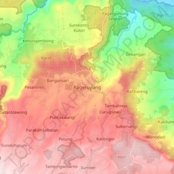
Name: Pageruyung topographic map, elevation, terrain.

Location: Pageruyung, Kendal, Central Java, Java, Indonesia (-7.08373 110.00291 -7.00373 110.08291)

Average elevation: 1,214 ft

Minimum elevation: 95 ft

Maximum elevation: 2,031 ft

Gear up for your next adventure:

😴Insulated Sleeping Pads - Compact and warm pads for high-elevation camping
📷Action Cameras - Rugged cameras to document your journeys across rugged terrain
🧭Compass with Lanyard - Easy‑carry compass for navigation
🧥Waterproof Jacket for Hiking - Breathable and rugged rain jacket for outdoor excursions
🔭Stargazing Telescopes - Perfect for camping in low-light pollution areas shown on maps

As an Amazon Associate, this site earns from qualifying purchases at no extra cost to you.