Geolocate

Weiding topographic map

Click on the map to display elevation.

About this map

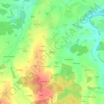
Name: Weiding topographic map, elevation, terrain.

Location: Weiding, Schnaitsee, Landkreis Traunstein, Bayern, Deutschland (48.06309 12.42363 48.10309 12.46363)

Average elevation: 1,745 ft

Minimum elevation: 1,611 ft

Maximum elevation: 1,916 ft

Gear up for your next adventure:

Backpacking Tents - Weight-optimized shelters for multi-day topographic surveys
🦶Hiking Gaiters - Keep debris and water out of your boots
🗺️NatGeo Topo Maps - High-quality waterproof printed topographic maps of US Parks
🧭Hiking Compass - Precision compass for reliable navigation in the wilderness
🌐World Map Poster - Decorative world maps with topographic info

As an Amazon Associate, this site earns from qualifying purchases at no extra cost to you.