Geolocate

Bachham topographic map

Click on the map to display elevation.

About this map

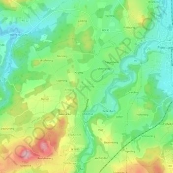
Name: Bachham topographic map, elevation, terrain.

Location: Bachham, Prien am Chiemsee, Landkreis Rosenheim, Bayern, 83209, Deutschland (47.82511 12.29534 47.86511 12.33534)

Average elevation: 1,900 ft

Minimum elevation: 1,690 ft

Maximum elevation: 2,254 ft

Other topographic maps

Click on a map to view its topography, its elevation and its terrain.

Gear up for your next adventure:

🔭Compact Binoculars - HD vision for scouting terrain and identifying distant landmarks
📷Action Camera - Capture your outdoor adventures in HD
📚USA Hiking Guide Books - Top trail guides and map books
🪶Paracord Bracelet - Survival bracelet with built‑in tools
📦Dry Bags Set - Waterproof storage for electronics and clothes

As an Amazon Associate, this site earns from qualifying purchases at no extra cost to you.