
Thank you for supporting this site ❤️
Make a donation
Make a donation
Gear up for your next adventure:
As an Amazon Associate, this site earns from qualifying purchases at no extra cost to you.
Dahlenberg topographic map
Click on the map to display elevation.
Thank you for supporting this site ❤️
Make a donation
Make a donation
Gear up for your next adventure:
As an Amazon Associate, this site earns from qualifying purchases at no extra cost to you.
About this map
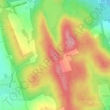
Name: Dahlenberg topographic map, elevation, terrain.
Location: Dahlenberg, Salzgitter, Niedersachsen, 38275, Deutschland (52.08311 10.34734 52.08321 10.34744)
Average elevation: 666 ft
Minimum elevation: 443 ft
Maximum elevation: 860 ft
Thank you for supporting this site ❤️
Make a donation
Make a donation
Gear up for your next adventure:
As an Amazon Associate, this site earns from qualifying purchases at no extra cost to you.