Geolocate

Hanover topographic map

Click on the map to display elevation.

About this map

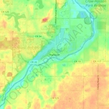
Name: Hanover topographic map, elevation, terrain.

Location: Hanover, Wright County, Minnesota, 55341, United States (45.13759 -93.70715 45.17420 -93.62978)

Average elevation: 955 ft

Minimum elevation: 876 ft

Maximum elevation: 1,027 ft

Wright County trails, hiking, mountain biking, running and outdoor activities

Gear up for your next adventure:

📚USA Hiking Guide Books - Top trail guides and map books
📦Gear Storage Bags - Organize and protect outdoor equipment
🪶Thermal Camp Blanket - Extra warmth for cold nights
Backpacking Tent - Lightweight and durable tent for multi‑day hikes
🪶Camp Gear Gift Set - Perfect gift bundle for outdoor fans

As an Amazon Associate, this site earns from qualifying purchases at no extra cost to you.