Geolocate

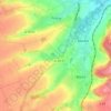
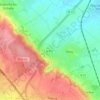
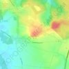
Carvin topographic map

Click on the map to display elevation.

About this map

Name: Carvin topographic map, elevation, terrain.

Location: Carvin, Lens, Pas-de-Calais, Hauts-de-France, Metropolitan France, 62220, France (50.46795 2.90913 50.51264 2.99459)

Average elevation: 95 ft

Minimum elevation: 59 ft

Maximum elevation: 331 ft

Other topographic maps

Click on a map to view its topography, its elevation and its terrain.

Panehem

France > Hauts-de-France > Pas-de-Calais > Samer

Average elevation: 230 ft

Cap Blanc Nez

France > Hauts-de-France > Pas-de-Calais > Escalles

Average elevation: 108 ft

Noyelles

France > Hauts-de-France > Pas-de-Calais > Bours

Average elevation: 410 ft

Le Petit Vimy

France > Hauts-de-France > Pas-de-Calais > Vimy

Average elevation: 305 ft

Entre Deux Chemins

France > Hauts-de-France > Pas-de-Calais > Herly

Average elevation: 558 ft

Mont Pourri

France > Hauts-de-France > Pas-de-Calais > Saint-Aubin

Average elevation: 105 ft

Gear up for your next adventure:

🪶Compact Camp Shovel - Folding shovel for campsite tasks
🛰️Handheld GPS Units - Professional satellite navigators for precise backcountry mapping
🪵Folding Camp Saw - Compact saw for wood and campsite work
🧴Hand Sanitizer - Keep hands clean while hiking
🪄Magnetic Compass - Accurate compass for navigation

As an Amazon Associate, this site earns from qualifying purchases at no extra cost to you.