Geolocate

Penshurst topographic map

Click on the map to display elevation.

About this map
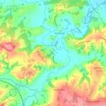
Name: Penshurst topographic map, elevation, terrain.

Location: Penshurst, Sevenoaks, Kent, England, United Kingdom (51.13180 0.15014 51.19077 0.21539)

Average elevation: 217 ft

Minimum elevation: 79 ft

Maximum elevation: 443 ft

Gear up for your next adventure:

☕Camping Coffee Makers - Enjoy premium coffee at the summit or campsite
🛠️Outdoor Gear Repair Kit - Essential tools to fix gear on the trail
🥩Freeze-Dried Meals - Nutritious and lightweight food for remote expeditions
⌚GPS Sports Watch - GPS watch for running, hiking and training
🌐World Map Poster - Decorative world maps with topographic info

As an Amazon Associate, this site earns from qualifying purchases at no extra cost to you.