
Thank you for supporting this site ❤️
Make a donation
Make a donation
Gear up for your next adventure:
As an Amazon Associate, this site earns from qualifying purchases at no extra cost to you.
Axtell topographic map
Click on the map to display elevation.
Thank you for supporting this site ❤️
Make a donation
Make a donation
Gear up for your next adventure:
As an Amazon Associate, this site earns from qualifying purchases at no extra cost to you.
About this map
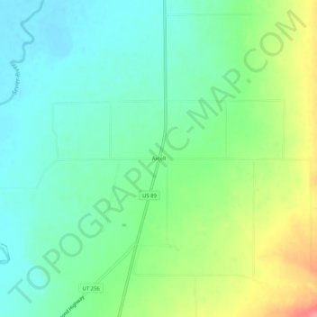
Name: Axtell topographic map, elevation, terrain.
Location: Axtell, Sanpete County, Utah, 84621, United States (39.03524 -111.84187 39.07524 -111.80187)
Average elevation: 5,157 ft
Minimum elevation: 5,069 ft
Maximum elevation: 5,341 ft
Thank you for supporting this site ❤️
Make a donation
Make a donation
Gear up for your next adventure:
As an Amazon Associate, this site earns from qualifying purchases at no extra cost to you.