Geolocate

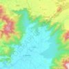
Sispara topographic map

Click on the map to display elevation.

About this map

Name: Sispara topographic map, elevation, terrain.

Location: Sispara, Nilambur, Malappuram, Kerala, India (11.20384 76.42990 11.20394 76.43000)

Average elevation: 5,610 ft

Minimum elevation: 3,730 ft

Maximum elevation: 7,031 ft

Other topographic maps

Click on a map to view its topography, its elevation and its terrain.

Munderi

India > Kerala > Nilambur

Average elevation: 1,506 ft

Muthukadu

India > Kerala > Nilambur > Nilambur

Average elevation: 118 ft

Nilamboor

India > Kerala > Nilambur

Average elevation: 1,808 ft

Gear up for your next adventure:

❄️Traction Cleats - Prevent slips on icy trails during winter hikes
🪑Portable Camp Table - Compact table for campsite meals
📷Action Cameras - Rugged cameras to document your journeys across rugged terrain
🏥Hiking First Aid Kits - Comprehensive medical kits for remote trail injuries
🎒Trekking Poles - Sturdy poles for balance and stability on rough terrain

As an Amazon Associate, this site earns from qualifying purchases at no extra cost to you.