
Thank you for supporting this site ❤️
Make a donation
Make a donation
Gear up for your next adventure:
As an Amazon Associate, this site earns from qualifying purchases at no extra cost to you.
Dharur topographic map
Click on the map to display elevation.
Thank you for supporting this site ❤️
Make a donation
Make a donation
Gear up for your next adventure:
As an Amazon Associate, this site earns from qualifying purchases at no extra cost to you.
About this map
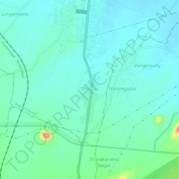
Name: Dharur topographic map, elevation, terrain.
Location: Dharur, Jagtial mandal, Jagtial, Telangana, 505455, India (18.74391 78.89367 18.78391 78.93367)
Average elevation: 968 ft
Minimum elevation: 909 ft
Maximum elevation: 1,230 ft
Thank you for supporting this site ❤️
Make a donation
Make a donation
Gear up for your next adventure:
As an Amazon Associate, this site earns from qualifying purchases at no extra cost to you.