
Thank you for supporting this site ❤️
Make a donation
Make a donation
Gear up for your next adventure:
As an Amazon Associate, this site earns from qualifying purchases at no extra cost to you.
Arma topographic map
Click on the map to display elevation.
Thank you for supporting this site ❤️
Make a donation
Make a donation
Gear up for your next adventure:
As an Amazon Associate, this site earns from qualifying purchases at no extra cost to you.
About this map
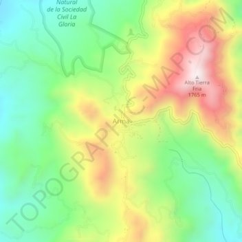
Name: Arma topographic map, elevation, terrain.
Location: Arma, Aguadas, Norte, Caldas, Colombia (5.59524 -75.56014 5.63524 -75.52014)
Average elevation: 4,262 ft
Minimum elevation: 3,232 ft
Maximum elevation: 5,764 ft
Thank you for supporting this site ❤️
Make a donation
Make a donation
Gear up for your next adventure:
As an Amazon Associate, this site earns from qualifying purchases at no extra cost to you.