
Thank you for supporting this site ❤️
Make a donation
Make a donation
Gear up for your next adventure:
As an Amazon Associate, this site earns from qualifying purchases at no extra cost to you.
Centro topographic map
Click on the map to display elevation.
Thank you for supporting this site ❤️
Make a donation
Make a donation
Gear up for your next adventure:
As an Amazon Associate, this site earns from qualifying purchases at no extra cost to you.
About this map
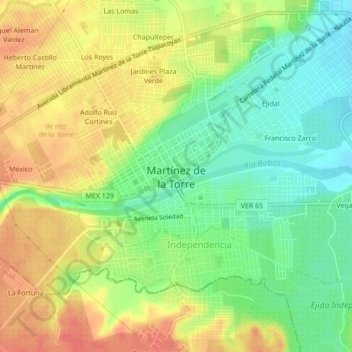
Name: Centro topographic map, elevation, terrain.
Location: Centro, Martínez de la Torre, Veracruz, 93603, Mexico (20.04157 -97.07457 20.08157 -97.03457)
Average elevation: 253 ft
Minimum elevation: 164 ft
Maximum elevation: 341 ft
Thank you for supporting this site ❤️
Make a donation
Make a donation
Gear up for your next adventure:
As an Amazon Associate, this site earns from qualifying purchases at no extra cost to you.