Geolocate

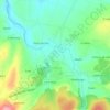
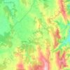
Mosteiro topographic map

Click on the map to display elevation.

About this map

Name: Mosteiro topographic map, elevation, terrain.

Location: Mosteiro, Pol, Meira, Lugo, Galicia, 27270, España (43.11017 -7.37351 43.15017 -7.33351)

Average elevation: 1,745 ft

Minimum elevation: 1,509 ft

Maximum elevation: 2,205 ft

Other topographic maps

Click on a map to view its topography, its elevation and its terrain.

A Órrea

España > Galicia > Meira > Riotorto

Average elevation: 1,726 ft

Mosteiro

España > Galicia > Meira > Pol

Average elevation: 1,683 ft

Milleirós

España > Galicia > Meira > Pol

Average elevation: 2,152 ft

Riotorto

España > Galicia > Meira

Average elevation: 1,460 ft

Galegos

España > Galicia > Meira > Riotorto

Average elevation: 1,165 ft

Pol

España > Galicia > Meira

Las mayores altitudes están hacia el este (Pena Grande, 935m, "Montes da Ferradura", 809 m y Penedo do Pao, 827 m). En los límites con Castro de Rey la altitud apenas supera los 400 m y las Colinas intermedias no superan los 650 m. De ellos parten numerosos arroyos y ríos.

Average elevation: 1,932 ft
Meira

España > Galicia > Meira

Average elevation: 1,883 ft

Meira

España > Galicia > Meira

Average elevation: 1,883 ft

Gear up for your next adventure:

🩳Quick‑Dry Hiking Shorts - Comfortable and quick‑dry shorts for summer hiking
📶Satellite Messenger - Communication device off‑grid
📖Nature Tracking Books - Learn to track wildlife and terrain
🪶Trail Camera - Capture wildlife on your hikes
🛰️Handheld GPS Units - Professional satellite navigators for precise backcountry mapping

As an Amazon Associate, this site earns from qualifying purchases at no extra cost to you.