Geolocate

Sprinkling Tarn topographic map

Click on the map to display elevation.

About this map

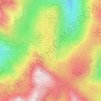
Name: Sprinkling Tarn topographic map, elevation, terrain.

Location: Sprinkling Tarn, Borrowdale, Cumbria, England, United Kingdom (54.47080 -3.19475 54.47298 -3.19126)

Average elevation: 1,955 ft

Minimum elevation: 702 ft

Maximum elevation: 2,992 ft

Gear up for your next adventure:

🕶️GPS Smartphone Mount - Secure mount for phone navigation
🛠️Backpacking Tool Kit - Essential toolkit for outdoor repairs
🌡️Handheld Weather Meters - Measure wind, temp, and pressure for safe mountain travel
🎁Geography Themed Gifts - Unique gift ideas for map lovers and geography enthusiasts
🧤Hiking Gloves - Protective gloves for rugged trails

As an Amazon Associate, this site earns from qualifying purchases at no extra cost to you.