Geolocate

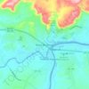
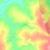
Feliz Natal topographic map

Click on the map to display elevation.

About this map

Name: Feliz Natal topographic map, elevation, terrain.

Location: Feliz Natal, Mato Grosso, Central-West Region, 78885-000, Brazil (-12.74138 -55.27805 -10.95869 -53.23700)

Average elevation: 1,132 ft

Minimum elevation: 814 ft

Maximum elevation: 1,667 ft

Other topographic maps

Click on a map to view its topography, its elevation and its terrain.

Estirão Comprido

Brazil > Mato Grosso > Cáceres

Average elevation: 328 ft

Barra do Garças

Brazil > Mato Grosso > Barra do Garças

Average elevation: 1,224 ft

Nova União

Brazil > Mato Grosso > Cotriguaçu

Average elevation: 633 ft

Retiro Miranda

Brazil > Mato Grosso > Barão de Melgaço

Average elevation: 466 ft

Santa Rita

Brazil > Mato Grosso > Marcelândia

Average elevation: 1,053 ft

Laguna

Brazil > Mato Grosso > Santo Antônio de Leverger

Average elevation: 548 ft

Córrego do Sol

Brazil > Mato Grosso > Nova Ubiratã

Average elevation: 1,263 ft

Rio Poxoréo

Brazil > Mato Grosso > Poxoréu

Average elevation: 1,293 ft

Motel Motreal

Brazil > Mato Grosso > Confresa

Average elevation: 719 ft

Gear up for your next adventure:

🧼Biodegradable Camping Soap - Eco‑friendly soap for outdoor hygiene
💧Water Filtration Bottles - Safely drink from streams and lakes while exploring
📱Heavy-Duty Phone Cases - Drop-proof and waterproof protection for outdoor navigation
🌡️Handheld Weather Meters - Measure wind, temp, and pressure for safe mountain travel
🥤Water Filter Bottle - All‑in‑one filter bottle for safe hydration

As an Amazon Associate, this site earns from qualifying purchases at no extra cost to you.