
Thank you for supporting this site ❤️
Make a donation
Make a donation
Gear up for your next adventure:
As an Amazon Associate, this site earns from qualifying purchases at no extra cost to you.
Büren topographic map
Click on the map to display elevation.
Thank you for supporting this site ❤️
Make a donation
Make a donation
Gear up for your next adventure:
As an Amazon Associate, this site earns from qualifying purchases at no extra cost to you.
About this map
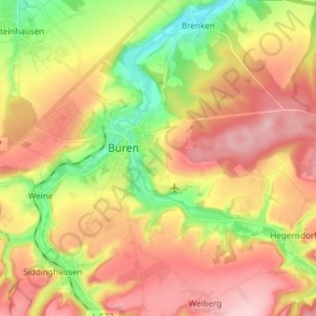
Name: Büren topographic map, elevation, terrain.
Location: Büren, Kreis Paderborn, North Rhine-Westphalia, 33142, Germany (51.51988 8.51848 51.57944 8.64718)
Average elevation: 938 ft
Minimum elevation: 617 ft
Maximum elevation: 1,227 ft
Thank you for supporting this site ❤️
Make a donation
Make a donation
Gear up for your next adventure:
As an Amazon Associate, this site earns from qualifying purchases at no extra cost to you.