
Thank you for supporting this site ❤️
Make a donation
Make a donation
Gear up for your next adventure:
As an Amazon Associate, this site earns from qualifying purchases at no extra cost to you.
Hamtah topographic map
Click on the map to display elevation.
Thank you for supporting this site ❤️
Make a donation
Make a donation
Gear up for your next adventure:
As an Amazon Associate, this site earns from qualifying purchases at no extra cost to you.
About this map
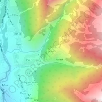
Name: Hamtah topographic map, elevation, terrain.
Location: Hamtah, Parini, Manali, Kullu, Himachal Pradesh, 175143, India (32.20574 77.19234 32.24574 77.23234)
Average elevation: 7,858 ft
Minimum elevation: 5,650 ft
Maximum elevation: 10,991 ft
Thank you for supporting this site ❤️
Make a donation
Make a donation
Gear up for your next adventure:
As an Amazon Associate, this site earns from qualifying purchases at no extra cost to you.