
Thank you for supporting this site ❤️
Make a donation
Make a donation
Gear up for your next adventure:
As an Amazon Associate, this site earns from qualifying purchases at no extra cost to you.
Gañil topographic map
Click on the map to display elevation.
Thank you for supporting this site ❤️
Make a donation
Make a donation
Gear up for your next adventure:
As an Amazon Associate, this site earns from qualifying purchases at no extra cost to you.
About this map
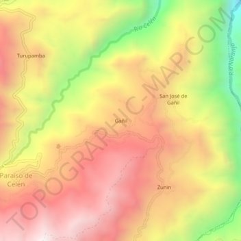
Name: Gañil topographic map, elevation, terrain.
Location: Gañil, El Paraíso de Celen, Saraguro, Loja, Ecuador (-3.61153 -79.34245 -3.57153 -79.30245)
Average elevation: 8,586 ft
Minimum elevation: 6,365 ft
Maximum elevation: 10,157 ft
Thank you for supporting this site ❤️
Make a donation
Make a donation
Gear up for your next adventure:
As an Amazon Associate, this site earns from qualifying purchases at no extra cost to you.