Geolocate

Burlington topographic map

Click on the map to display elevation.

About this map

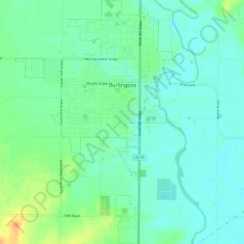
Name: Burlington topographic map, elevation, terrain.

Location: Burlington, Coffey County, Kansas, United States (38.16503 -95.76789 38.21012 -95.73026)

Average elevation: 1,033 ft

Minimum elevation: 997 ft

Maximum elevation: 1,115 ft

Coffey County trails, hiking, mountain biking, running and outdoor activities

Gear up for your next adventure:

📚USA Hiking Guide Books - Top trail guides and map books
🏥Hiking First Aid Kits - Comprehensive medical kits for remote trail injuries
👟Trail Running Shoes - Lightweight shoes for trail runners
🌡️Handheld Weather Meters - Measure wind, temp, and pressure for safe mountain travel
🏫Relief Map Kits - Hands-on tools for teaching landforms and elevation

As an Amazon Associate, this site earns from qualifying purchases at no extra cost to you.