
Thank you for supporting this site ❤️
Make a donation
Make a donation
Gear up for your next adventure:
As an Amazon Associate, this site earns from qualifying purchases at no extra cost to you.
Benkelman topographic map
Click on the map to display elevation.
Thank you for supporting this site ❤️
Make a donation
Make a donation
Gear up for your next adventure:
As an Amazon Associate, this site earns from qualifying purchases at no extra cost to you.
About this map
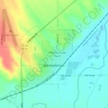
Name: Benkelman topographic map, elevation, terrain.
Location: Benkelman, Dundy County, Nebraska, 69021, United States (40.04245 -101.54424 40.06157 -101.52619)
Average elevation: 3,018 ft
Minimum elevation: 2,949 ft
Maximum elevation: 3,153 ft
Dundy County trails, hiking, mountain biking, running and outdoor activities
Thank you for supporting this site ❤️
Make a donation
Make a donation
Gear up for your next adventure:
As an Amazon Associate, this site earns from qualifying purchases at no extra cost to you.