
Thank you for supporting this site ❤️
Make a donation
Make a donation
Gear up for your next adventure:
As an Amazon Associate, this site earns from qualifying purchases at no extra cost to you.
Gwafan topographic map
Click on the map to display elevation.
Thank you for supporting this site ❤️
Make a donation
Make a donation
Gear up for your next adventure:
As an Amazon Associate, this site earns from qualifying purchases at no extra cost to you.
About this map
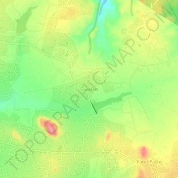
Name: Gwafan topographic map, elevation, terrain.
Location: Gwafan, Jos North, Plateau State, 930106, Nigeria (9.88000 8.94667 9.92000 8.98667)
Average elevation: 4,278 ft
Minimum elevation: 4,094 ft
Maximum elevation: 4,485 ft
Thank you for supporting this site ❤️
Make a donation
Make a donation
Gear up for your next adventure:
As an Amazon Associate, this site earns from qualifying purchases at no extra cost to you.