
Thank you for supporting this site ❤️
Make a donation
Make a donation
Gear up for your next adventure:
As an Amazon Associate, this site earns from qualifying purchases at no extra cost to you.
Delek topographic map
Click on the map to display elevation.
Thank you for supporting this site ❤️
Make a donation
Make a donation
Gear up for your next adventure:
As an Amazon Associate, this site earns from qualifying purchases at no extra cost to you.
About this map
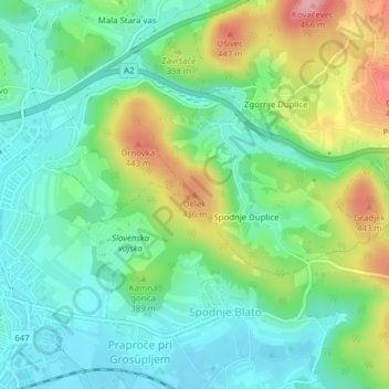
Name: Delek topographic map, elevation, terrain.
Location: Delek, Grosuplje, Upravna Enota Grosuplje, 1290, Slovenia (45.96370 14.67920 45.96380 14.67930)
Average elevation: 1,220 ft
Minimum elevation: 1,070 ft
Maximum elevation: 1,535 ft
Thank you for supporting this site ❤️
Make a donation
Make a donation
Gear up for your next adventure:
As an Amazon Associate, this site earns from qualifying purchases at no extra cost to you.