Geolocate

Pittsburg topographic map

Click on the map to display elevation.

About this map

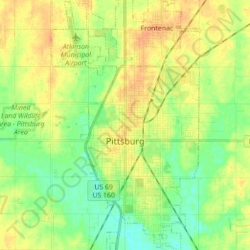
Name: Pittsburg topographic map, elevation, terrain.

Location: Pittsburg, Crawford County, Kansas, 66762, United States (37.36744 -94.74166 37.46642 -94.66752)

Average elevation: 922 ft

Minimum elevation: 873 ft

Maximum elevation: 968 ft

Crawford County trails, hiking, mountain biking, running and outdoor activities

Gear up for your next adventure:

📷Action Cameras - Rugged cameras to document your journeys across rugged terrain
🪑Portable Camp Table - Compact table for campsite meals
📱Heavy-Duty Phone Cases - Drop-proof and waterproof protection for outdoor navigation
🔋Solar Power Banks - Keep your GPS and phone charged in remote wilderness areas
🧥Waterproof Jacket for Hiking - Breathable and rugged rain jacket for outdoor excursions

As an Amazon Associate, this site earns from qualifying purchases at no extra cost to you.