Geolocate

Guam topographic map

Click on the map to display elevation.

About this map

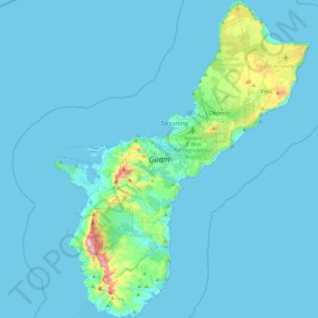
Name: Guam topographic map, elevation, terrain.

Location: Guam, Chalan Pago-Ordot Municipality, Guam, United States (13.24599 144.61832 13.65438 144.95696)

Average elevation: 85 ft

Minimum elevation: 0 ft

Maximum elevation: 1,266 ft

Chalan Pago-Ordot Municipality trails, hiking, mountain biking, running and outdoor activities

Gear up for your next adventure:

📶Vehicle Signal Boosters - Improve reception in rural areas while driving to trailheads
🧺Microfiber Travel Towels - Compact and fast-drying towels for trail use
📚USA Hiking Guide Books - Top trail guides and map books
🧥Waterproof Jacket for Hiking - Breathable and rugged rain jacket for outdoor excursions
🪶LED Camping Lantern - Bright lantern for camp lighting

As an Amazon Associate, this site earns from qualifying purchases at no extra cost to you.