Geolocate

Swaledale topographic map

Click on the map to display elevation.

About this map

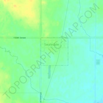
Name: Swaledale topographic map, elevation, terrain.

Location: Swaledale, Cerro Gordo County, Iowa, United States (42.97279 -93.32039 42.98010 -93.31055)

Average elevation: 1,155 ft

Minimum elevation: 1,122 ft

Maximum elevation: 1,204 ft

Cerro Gordo County trails, hiking, mountain biking, running and outdoor activities

Other topographic maps

Click on a map to view its topography, its elevation and its terrain.

Hanford

United States > Iowa > Cerro Gordo County

Average elevation: 1,184 ft

Portland

United States > Iowa > Cerro Gordo County > Portland

Average elevation: 1,096 ft

Gear up for your next adventure:

🪶LED Camping Lantern - Bright lantern for camp lighting
🌐World Map Poster - Decorative world maps with topographic info
🪶Camp Gear Gift Set - Perfect gift bundle for outdoor fans
🏕️Family Camping Gear - Essentials for group camping trips
🎁Geography Themed Gifts - Unique gift ideas for map lovers and geography enthusiasts

As an Amazon Associate, this site earns from qualifying purchases at no extra cost to you.