
Make a donation
Gear up for your next adventure:
As an Amazon Associate, this site earns from qualifying purchases at no extra cost to you.
Sandlick topographic map
Click on the map to display elevation.
Make a donation
Gear up for your next adventure:
As an Amazon Associate, this site earns from qualifying purchases at no extra cost to you.
About this map
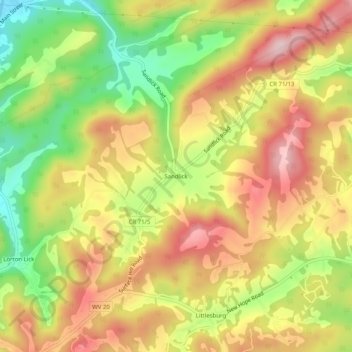
Name: Sandlick topographic map, elevation, terrain.
Location: Sandlick, Mercer County, West Virginia, 24737, United States (37.31928 -81.24010 37.35928 -81.20010)
Average elevation: 2,667 ft
Minimum elevation: 2,192 ft
Maximum elevation: 3,077 ft
Mercer County trails, hiking, mountain biking, running and outdoor activities
Make a donation
Gear up for your next adventure:
As an Amazon Associate, this site earns from qualifying purchases at no extra cost to you.
Other topographic maps
Click on a map to view its topography, its elevation and its terrain.
Pinnacle Rock State Park
United States > West Virginia > Mercer County > Nemours
Average elevation: 2,533 ft