
Thank you for supporting this site ❤️
Make a donation
Make a donation
Gear up for your next adventure:
As an Amazon Associate, this site earns from qualifying purchases at no extra cost to you.
Sternwarte topographic map
Click on the map to display elevation.
Thank you for supporting this site ❤️
Make a donation
Make a donation
Gear up for your next adventure:
As an Amazon Associate, this site earns from qualifying purchases at no extra cost to you.
About this map
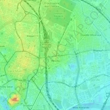
Name: Sternwarte topographic map, elevation, terrain.
Location: Sternwarte, Grzegórzki, Krakau, Woiwodschaft Kleinpolen, Polen (50.05644 19.94211 50.07421 19.96025)
Average elevation: 696 ft
Minimum elevation: 653 ft
Maximum elevation: 768 ft
Thank you for supporting this site ❤️
Make a donation
Make a donation
Gear up for your next adventure:
As an Amazon Associate, this site earns from qualifying purchases at no extra cost to you.