
San Rafael topographic map
Interactive map
Click on the map to display elevation.
About this map
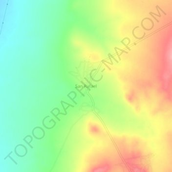
Name: San Rafael topographic map, elevation, terrain.
Location: San Rafael, Villa de Ramos, San Luis Potosí, México (23.00212 -101.96460 23.04212 -101.92460)
Average elevation: 7,077 ft
Minimum elevation: 6,923 ft
Maximum elevation: 7,254 ft
Other topographic maps
Click on a map to view its topography, its elevation and its terrain.
El Barril
México > San Luis Potosí > Villa de Ramos > El Barril
El Barril, Villa de Ramos, San Luis Potosí, México
Average elevation: 6,512 ft