
Aker topographic map
Interactive map
Click on the map to display elevation.
About this map
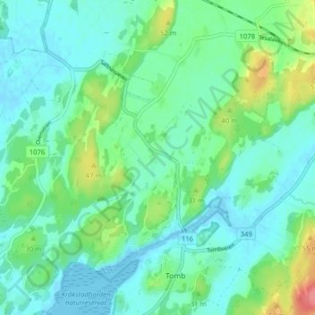
Name: Aker topographic map, elevation, terrain.
Location: Aker, Råde, Viken, 1643, Noruega (59.31431 10.78083 59.35431 10.82083)
Average elevation: 56 ft
Minimum elevation: -10 ft
Maximum elevation: 233 ft
Other topographic maps
Click on a map to view its topography, its elevation and its terrain.