
Make a donation
Gear up for your next adventure:
As an Amazon Associate, this site earns from qualifying purchases at no extra cost to you.
Arbergen topographic map
Click on the map to display elevation.
Make a donation
Gear up for your next adventure:
As an Amazon Associate, this site earns from qualifying purchases at no extra cost to you.
Arbergen
Hastedt (Plattdeutsch ebenfalls Hastedt), 1226 als Herstede zuerst urkundlich erwähnt, gehört seit 1803 zur Landgemeinde Bremen und wurde 1902 in die Stadt Bremen eingemeindet. Als 1939 das damals preußische Hemelingen als Stadtteil zu Bremen kam, wurde Hastedt ein Ortsteil von Bremen-Hemelingen. Der Straßenname Bei den drei Pfählen erinnert noch heute an die frühere Grenze zwischen Bremen und Hastedt. Diese verlief in Höhe der heutigen Stader Straße. Die Hastedter Heerstraße ist in Bremen die Straße mit der sechsthöchsten Hausnummer (Nr. 447) und die Hauptstraße des Ortsteiles. Sie wurde 1812 ausgebaut und hieß bis 1915 Hastedter Chaussee.
Make a donation
Gear up for your next adventure:
As an Amazon Associate, this site earns from qualifying purchases at no extra cost to you.
About this map
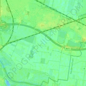
Name: Arbergen topographic map, elevation, terrain.
Location: Arbergen, Hemelingen, Bremen-Ost, Bremen, 28307, Deutschland (53.01104 8.89573 53.04974 8.93099)
Average elevation: 23 ft
Minimum elevation: -26 ft
Maximum elevation: 46 ft
Make a donation
Gear up for your next adventure:
As an Amazon Associate, this site earns from qualifying purchases at no extra cost to you.
Other topographic maps
Click on a map to view its topography, its elevation and its terrain.
Make a donation
Gear up for your next adventure:
As an Amazon Associate, this site earns from qualifying purchases at no extra cost to you.