
Thank you for supporting this site ❤️
Make a donation
Make a donation
Gear up for your next adventure:
As an Amazon Associate, this site earns from qualifying purchases at no extra cost to you.
Strygge topographic map
Click on the map to display elevation.
Thank you for supporting this site ❤️
Make a donation
Make a donation
Gear up for your next adventure:
As an Amazon Associate, this site earns from qualifying purchases at no extra cost to you.
About this map
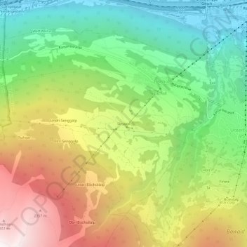
Name: Strygge topographic map, elevation, terrain.
Location: Strygge, Eischoll, Westlich Raron, Wallis, 3943, Schweiz (46.26680 7.75224 46.30680 7.79224)
Average elevation: 4,751 ft
Minimum elevation: 2,067 ft
Maximum elevation: 8,448 ft
Thank you for supporting this site ❤️
Make a donation
Make a donation
Gear up for your next adventure:
As an Amazon Associate, this site earns from qualifying purchases at no extra cost to you.