
Thank you for supporting this site ❤️
Make a donation
Make a donation
Gear up for your next adventure:
As an Amazon Associate, this site earns from qualifying purchases at no extra cost to you.
Rendinara topographic map
Click on the map to display elevation.
Thank you for supporting this site ❤️
Make a donation
Make a donation
Gear up for your next adventure:
As an Amazon Associate, this site earns from qualifying purchases at no extra cost to you.
About this map
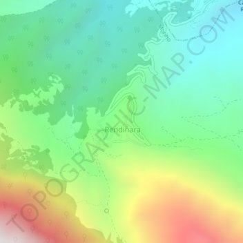
Name: Rendinara topographic map, elevation, terrain.
Location: Rendinara, L'Aquila, Abruzzo, Italia (41.83473 13.46640 41.83959 13.46970)
Average elevation: 2,877 ft
Minimum elevation: 1,335 ft
Maximum elevation: 5,899 ft
Thank you for supporting this site ❤️
Make a donation
Make a donation
Gear up for your next adventure:
As an Amazon Associate, this site earns from qualifying purchases at no extra cost to you.