
Thank you for supporting this site ❤️
Make a donation
Make a donation
Gear up for your next adventure:
As an Amazon Associate, this site earns from qualifying purchases at no extra cost to you.
Piquijaca topographic map
Click on the map to display elevation.
Thank you for supporting this site ❤️
Make a donation
Make a donation
Gear up for your next adventure:
As an Amazon Associate, this site earns from qualifying purchases at no extra cost to you.
About this map
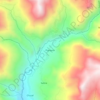
Name: Piquijaca topographic map, elevation, terrain.
Location: Piquijaca, San Felipe, Jaén, Cajamarca, Perú (-5.76148 -79.34615 -5.72148 -79.30615)
Average elevation: 6,161 ft
Minimum elevation: 4,770 ft
Maximum elevation: 7,848 ft
Thank you for supporting this site ❤️
Make a donation
Make a donation
Gear up for your next adventure:
As an Amazon Associate, this site earns from qualifying purchases at no extra cost to you.