
Thank you for supporting this site ❤️
Make a donation
Make a donation
Gear up for your next adventure:
As an Amazon Associate, this site earns from qualifying purchases at no extra cost to you.
Vallecitos topographic map
Click on the map to display elevation.
Thank you for supporting this site ❤️
Make a donation
Make a donation
Gear up for your next adventure:
As an Amazon Associate, this site earns from qualifying purchases at no extra cost to you.
About this map
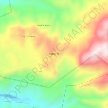
Name: Vallecitos topographic map, elevation, terrain.
Location: Vallecitos, La Libertad, Comayagua, Honduras (14.91714 -87.66919 14.95714 -87.62919)
Average elevation: 1,946 ft
Minimum elevation: 892 ft
Maximum elevation: 3,110 ft
Thank you for supporting this site ❤️
Make a donation
Make a donation
Gear up for your next adventure:
As an Amazon Associate, this site earns from qualifying purchases at no extra cost to you.