
Thank you for supporting this site ❤️
Make a donation
Make a donation
Gear up for your next adventure:
As an Amazon Associate, this site earns from qualifying purchases at no extra cost to you.
Dounby topographic map
Click on the map to display elevation.
Thank you for supporting this site ❤️
Make a donation
Make a donation
Gear up for your next adventure:
As an Amazon Associate, this site earns from qualifying purchases at no extra cost to you.
About this map
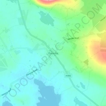
Name: Dounby topographic map, elevation, terrain.
Location: Dounby, Orkney Islands, Scotland, KW17 2HT, United Kingdom (59.04807 -3.25123 59.08807 -3.21123)
Average elevation: 75 ft
Minimum elevation: 0 ft
Maximum elevation: 371 ft
Thank you for supporting this site ❤️
Make a donation
Make a donation
Gear up for your next adventure:
As an Amazon Associate, this site earns from qualifying purchases at no extra cost to you.