
Thank you for supporting this site ❤️
Make a donation
Make a donation
Gear up for your next adventure:
As an Amazon Associate, this site earns from qualifying purchases at no extra cost to you.
Kandi topographic map
Click on the map to display elevation.
Thank you for supporting this site ❤️
Make a donation
Make a donation
Gear up for your next adventure:
As an Amazon Associate, this site earns from qualifying purchases at no extra cost to you.
About this map
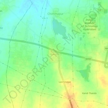
Name: Kandi topographic map, elevation, terrain.
Location: Kandi, Kandi mandal, Sangareddy, Telangana, 502285, India (17.56127 78.08845 17.60127 78.12845)
Average elevation: 1,736 ft
Minimum elevation: 1,683 ft
Maximum elevation: 1,795 ft
Thank you for supporting this site ❤️
Make a donation
Make a donation
Gear up for your next adventure:
As an Amazon Associate, this site earns from qualifying purchases at no extra cost to you.