Geolocate

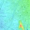
Parque Excombatientes topographic map

Click on the map to display elevation.

About this map

Name: Parque Excombatientes topographic map, elevation, terrain.

Location: Parque Excombatientes, 18 de Mayo, Molle, Cochabamba, Cercado, Cochabamba, Bolivia (-17.38656 -66.17870 -17.38462 -66.16767)

Average elevation: 8,412 ft

Minimum elevation: 8,373 ft

Maximum elevation: 8,474 ft

Other topographic maps

Click on a map to view its topography, its elevation and its terrain.

Plaza 10 de Febrero

Bolivia > Cochabamba > Cercado > Cochabamba

Average elevation: 8,724 ft

Plaza Avaroa

Bolivia > Cochabamba > Cercado > Cochabamba

Average elevation: 8,419 ft

Parque Kanata

Bolivia > Cochabamba > Cercado > Cochabamba

Average elevation: 8,445 ft

Plaza de los Arrieros

Bolivia > Cochabamba > Cercado > Cochabamba

Average elevation: 8,415 ft

Plaza 14 de Septiembre

Bolivia > Cochabamba > Cercado > Cochabamba

Average elevation: 8,438 ft

Gear up for your next adventure:

🦶Hiking Gaiters - Keep debris and water out of your boots
📻Weather Alert Radios - Stay informed of storm risks while off-the-grid
🎒Waterproof Dry Bags - Keep your electronics and maps dry inside your pack
🦟Ultrasonic Repellers - Create a bug-free zone at your camp or rest stop
🏫Relief Map Kits - Hands-on tools for teaching landforms and elevation

As an Amazon Associate, this site earns from qualifying purchases at no extra cost to you.