

Ballater topographic map
Click on the map to display elevation.
Ballater
Ballater (/ˈbælətər/, Scottish Gaelic: Bealadair) is a village in Aberdeenshire, Scotland, on the River Dee, immediately east of the Cairngorm Mountains. Situated at an elevation of 213 metres (699 feet), Ballater is a centre for hikers and known for its spring water, once said to cure scrofula. It is home to more than 1400 inhabitants and has had a long connection with the British royal family.
About this map
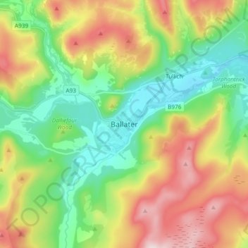
Name: Ballater topographic map, elevation, terrain.
Location: Ballater, Aberdeenshire, Scotland, AB35 5QD, United Kingdom (57.00951 -3.08052 57.08951 -3.00052)
Average elevation: 1,181 ft
Minimum elevation: 604 ft
Maximum elevation: 2,116 ft