
Thank you for supporting this site ❤️
Make a donation
Make a donation
Gear up for your next adventure:
As an Amazon Associate, this site earns from qualifying purchases at no extra cost to you.
Talavera topographic map
Click on the map to display elevation.
Thank you for supporting this site ❤️
Make a donation
Make a donation
Gear up for your next adventure:
As an Amazon Associate, this site earns from qualifying purchases at no extra cost to you.
About this map
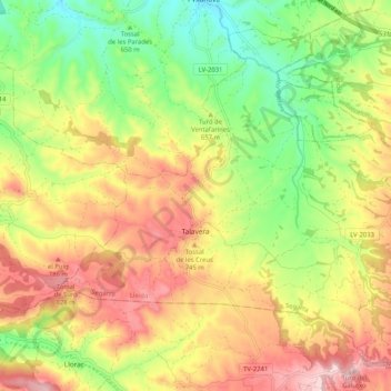
Name: Talavera topographic map, elevation, terrain.
Location: Talavera, Segarra, Lleida, Catalonia, Spain (41.55628 1.30413 41.62230 1.40704)
Average elevation: 2,277 ft
Minimum elevation: 1,788 ft
Maximum elevation: 2,805 ft
Thank you for supporting this site ❤️
Make a donation
Make a donation
Gear up for your next adventure:
As an Amazon Associate, this site earns from qualifying purchases at no extra cost to you.