
Thank you for supporting this site ❤️
Make a donation
Make a donation
Gear up for your next adventure:
As an Amazon Associate, this site earns from qualifying purchases at no extra cost to you.
Socorro topographic map
Click on the map to display elevation.
Thank you for supporting this site ❤️
Make a donation
Make a donation
Gear up for your next adventure:
As an Amazon Associate, this site earns from qualifying purchases at no extra cost to you.
About this map
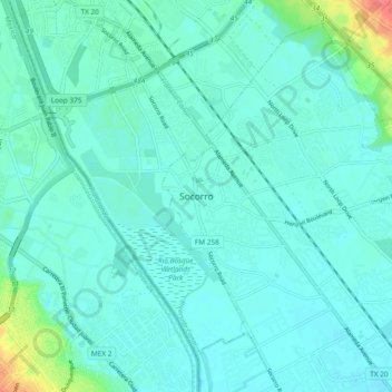
Name: Socorro topographic map, elevation, terrain.
Location: Socorro, El Paso County, Texas, 79927, United States (31.61456 -106.34331 31.69456 -106.26331)
Average elevation: 3,671 ft
Minimum elevation: 3,638 ft
Maximum elevation: 3,842 ft
Thank you for supporting this site ❤️
Make a donation
Make a donation
Gear up for your next adventure:
As an Amazon Associate, this site earns from qualifying purchases at no extra cost to you.