
Thank you for supporting this site ❤️
Make a donation
Make a donation
Gear up for your next adventure:
As an Amazon Associate, this site earns from qualifying purchases at no extra cost to you.
Veguilla topographic map
Click on the map to display elevation.
Thank you for supporting this site ❤️
Make a donation
Make a donation
Gear up for your next adventure:
As an Amazon Associate, this site earns from qualifying purchases at no extra cost to you.
About this map
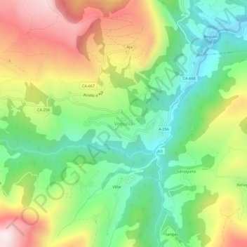
Name: Veguilla topographic map, elevation, terrain.
Location: Veguilla, Soba, Asón-Agüera, Cantabria, 39808, España (43.16791 -3.54338 43.20791 -3.50338)
Average elevation: 1,529 ft
Minimum elevation: 564 ft
Maximum elevation: 2,930 ft
Thank you for supporting this site ❤️
Make a donation
Make a donation
Gear up for your next adventure:
As an Amazon Associate, this site earns from qualifying purchases at no extra cost to you.