Geolocate

Bera topographic map

Click on the map to display elevation.

About this map

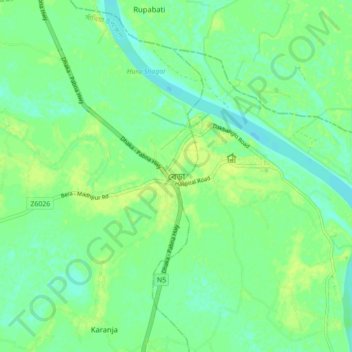
Name: Bera topographic map, elevation, terrain.

Location: Bera, Pabna district, Rajshahi Division, 6688, Bangladesh (24.03799 89.57035 24.11799 89.65035)

Average elevation: 30 ft

Minimum elevation: 7 ft

Maximum elevation: 52 ft

Gear up for your next adventure:

GPS Sports Watch - GPS watch for running, hiking and training
🛡️Insect Repellent - Protection against bugs during outdoor activities
🧥Waterproof Jacket for Hiking - Breathable and rugged rain jacket for outdoor excursions
📷Action Cameras - Rugged cameras to document your journeys across rugged terrain
📚USA Hiking Guide Books - Top trail guides and map books

As an Amazon Associate, this site earns from qualifying purchases at no extra cost to you.