
Thank you for supporting this site ❤️
Make a donation
Make a donation
Gear up for your next adventure:
As an Amazon Associate, this site earns from qualifying purchases at no extra cost to you.
Espinalba topographic map
Click on the map to display elevation.
Thank you for supporting this site ❤️
Make a donation
Make a donation
Gear up for your next adventure:
As an Amazon Associate, this site earns from qualifying purchases at no extra cost to you.
About this map
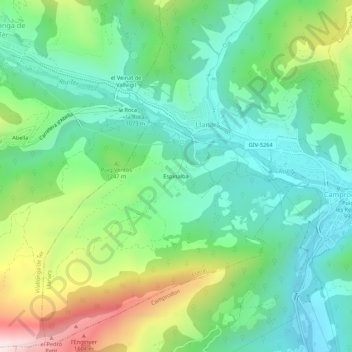
Name: Espinalba topographic map, elevation, terrain.
Location: Espinalba, Llanars, Ripollais, Gérone, Catalogne, 17869, Espagne (42.29486 2.31907 42.33486 2.35907)
Average elevation: 3,819 ft
Minimum elevation: 2,966 ft
Maximum elevation: 5,758 ft
Thank you for supporting this site ❤️
Make a donation
Make a donation
Gear up for your next adventure:
As an Amazon Associate, this site earns from qualifying purchases at no extra cost to you.