
Hallstead topographic map
Click on the map to display elevation.
About this map
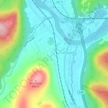
Name: Hallstead topographic map, elevation, terrain.
Location: Hallstead, Susquehanna County, Pennsylvania, United States (41.95139 -75.75442 41.97033 -75.74154)
Average elevation: 1,060 ft
Minimum elevation: 840 ft
Maximum elevation: 1,621 ft
Susquehanna County trails, hiking, mountain biking, running and outdoor activities
Other topographic maps
Click on a map to view its topography, its elevation and its terrain.
Heart Lake
United States > Pennsylvania > Susquehanna County > Bridgewater Township
Average elevation: 1,581 ft
Lake Erie
United States > Pennsylvania > Susquehanna County > Clifford Township
Average elevation: 1,696 ft
Elk Lake
United States > Pennsylvania > Susquehanna County > Dimock Township
Average elevation: 1,404 ft