Geolocate

Ibayo topographic map

Click on the map to display elevation.

About this map

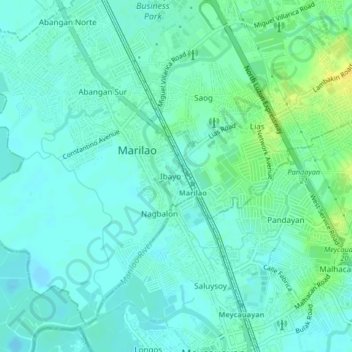
Name: Ibayo topographic map, elevation, terrain.

Location: Ibayo, Marilao, Bulacan, Central Luzon, 3019, Philippines (14.73458 120.93284 14.77458 120.97284)

Average elevation: 20 ft

Minimum elevation: -7 ft

Maximum elevation: 69 ft

Gear up for your next adventure:

🗺️NatGeo Topo Maps - High-quality waterproof printed topographic maps of US Parks
📡GPS Antenna Upgrade - Enhance GPS reception in remote terrain
❄️Traction Cleats - Prevent slips on icy trails during winter hikes
🥇GPS Hiking Watch - Multi‑sport GPS watch with navigation and trail tracking
Solar GPS Watches - Advanced multisport watches with built-in topographic maps

As an Amazon Associate, this site earns from qualifying purchases at no extra cost to you.