
Thank you for supporting this site ❤️
Make a donation
Make a donation
Gear up for your next adventure:
As an Amazon Associate, this site earns from qualifying purchases at no extra cost to you.
Sololo topographic map
Click on the map to display elevation.
Thank you for supporting this site ❤️
Make a donation
Make a donation
Gear up for your next adventure:
As an Amazon Associate, this site earns from qualifying purchases at no extra cost to you.
About this map
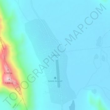
Name: Sololo topographic map, elevation, terrain.
Location: Sololo, Sololo ward, Moyale, Marsabit County, Kenya (3.54281 38.62361 3.58281 38.66361)
Average elevation: 2,490 ft
Minimum elevation: 2,238 ft
Maximum elevation: 4,331 ft
Thank you for supporting this site ❤️
Make a donation
Make a donation
Gear up for your next adventure:
As an Amazon Associate, this site earns from qualifying purchases at no extra cost to you.