
Haslett topographic map
Click on the map to display elevation.
About this map
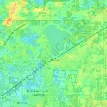
Name: Haslett topographic map, elevation, terrain.
Location: Haslett, Ingham County, Michigan, 48840, United States (42.73118 -84.44753 42.76999 -84.36339)
Average elevation: 863 ft
Minimum elevation: 823 ft
Maximum elevation: 925 ft
Ingham County trails, hiking, mountain biking, running and outdoor activities
Other topographic maps
Click on a map to view its topography, its elevation and its terrain.
Burchfield Park
United States > Michigan > Ingham County > Delhi Charter Township
Average elevation: 879 ft
Village of Dansville Community Park
United States > Michigan > Ingham County > Dansville
Average elevation: 948 ft