
Make a donation
Gear up for your next adventure:
As an Amazon Associate, this site earns from qualifying purchases at no extra cost to you.
Ripon topographic map
Click on the map to display elevation.
Make a donation
Gear up for your next adventure:
As an Amazon Associate, this site earns from qualifying purchases at no extra cost to you.
About this map
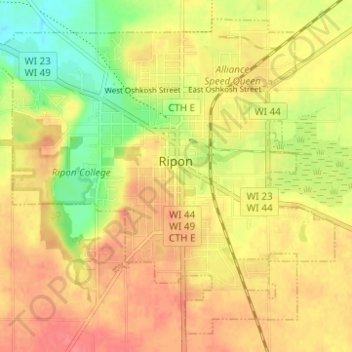
Name: Ripon topographic map, elevation, terrain.
Location: Ripon, Fond du Lac County, Wisconsin, 54971, United States (43.82050 -88.87115 43.86049 -88.80929)
Average elevation: 945 ft
Minimum elevation: 823 ft
Maximum elevation: 1,027 ft
Fond du Lac County trails, hiking, mountain biking, running and outdoor activities
Make a donation
Gear up for your next adventure:
As an Amazon Associate, this site earns from qualifying purchases at no extra cost to you.
Other topographic maps
Click on a map to view its topography, its elevation and its terrain.
Graham Corners
United States > Wisconsin > Fond du Lac County > Town of Forest
Average elevation: 1,060 ft