Geolocate

Neptune topographic map

Click on the map to display elevation.

About this map

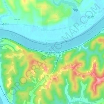
Name: Neptune topographic map, elevation, terrain.

Location: Neptune, Jackson County, West Virginia, United States (39.05536 -81.79985 39.09536 -81.75985)

Average elevation: 696 ft

Minimum elevation: 564 ft

Maximum elevation: 978 ft

Jackson County trails, hiking, mountain biking, running and outdoor activities

Other topographic maps

Click on a map to view its topography, its elevation and its terrain.

Ripley

United States > West Virginia > Jackson County

Average elevation: 705 ft

Gear up for your next adventure:

🛰️Handheld GPS Units - Professional satellite navigators for precise backcountry mapping
📷Action Cameras - Rugged cameras to document your journeys across rugged terrain
📦Gear Storage Bags - Organize and protect outdoor equipment
🎒Waterproof Dry Bags - Keep your electronics and maps dry inside your pack
👖Convertible Hiking Pants - Versatile zip-off pants for changing altitudes and temperatures

As an Amazon Associate, this site earns from qualifying purchases at no extra cost to you.