
Bano topographic map
Interactive map
Click on the map to display elevation.
About this map
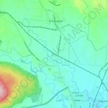
Name: Bano topographic map, elevation, terrain.
Location: Bano, Guantanamo, Guantánamo, 95400, Cuba (20.15278 -75.25588 20.23504 -75.19639)
Average elevation: 318 ft
Minimum elevation: 128 ft
Maximum elevation: 1,070 ft
Other topographic maps
Click on a map to view its topography, its elevation and its terrain.
Guantanamo
Cuba > Guantánamo > Guantanamo
Guantanamo, Guantánamo, 95100, Cuba
Average elevation: 482 ft